• Thumb image
    2025 Mob Match

    May 11th

    Join us for this spring's Mob Match as we return to Palgrave Forest!

  • Thumb image
    2025 Schools Orienteering

    May 14th

    43rd annual Orienteering ADVENTURE RACE for schools

    • Cross-Country running with map and compass
    • 8 different age classes M/F: 11-12, 13-14, 15-16, 17-19
    • Medals for first three finishers in each age class
    • School trophies for 11- 14 and 15-19 age classes
  • Thumb image
    2025 Mountain Bike Score-O

    Jun 8th

    Come join us on June 8th where we combine 2 of our favourite sports - Mountain Biking and Orienteering!!

Recreational Park Series 

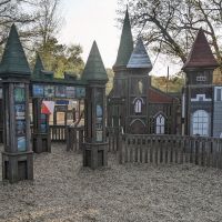
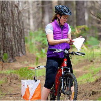
The Toronto Orienteering Club (TOC) invites you to orienteer in Toronto city parks. These informal, recreational events are for everyone – both beginners and experienced orienteers. Come and see how easy it is to start orienteering and enjoy the outdoors this summer. You’ll discover how interesting our many beautiful city parks can be while getting some good exercise.

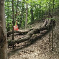
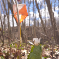
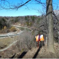
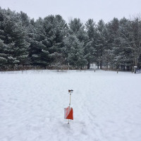
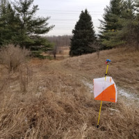
In-person registration will start at 6:15 on the Wednesday. The meeting place will be marked by an orange and white orienteering flag. Participation is FREE for TOC members, non-members will be asked to pay $5. After getting your course map you can run/walk the course at your leisure. The course will close at 8:00pm. There will usually be a beginner and an advanced course. You will also be able to receive informal orienteering instruction from TOC members at the registration area.

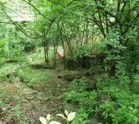
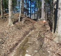
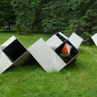
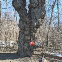
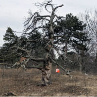
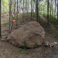
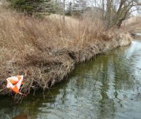
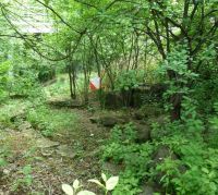
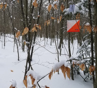
The controls to find on the course will be marked by short orange ribbons.  The ribbons will be in place for 1 week, so you have a  week to do the course. NOTE there is no guarantee that a ribbon will remain in place. Especially in busier areas of a park, other users of the park may remove them.

If you can't make it in person on the Wednesday, you can get a pdf copy of the course: 

  1. Sign up as a club member, if you are not already a TOC member
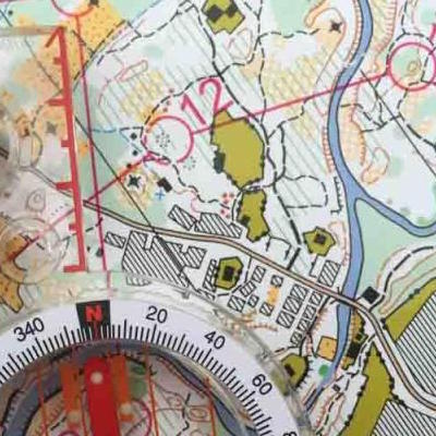
  2. AFTER MAY 1, send a signed waiver to [email protected] . Note - you only need to send ONE waiver per season. Once we have your waiver you will have access to the courses for the Park Series from May to Sept. You will be able to download the course in PDF format from here
  3. The course map for a particular park will be available for download starting on the Wed  for 1-2 weeks. 


GPS COURSES OR MAPRUN6 COURSES 

Some Wed courses may indicate that they also have a virtual (GPS) version, this allows you to find the controls using the MAPRUN6 app on your smartphone (you don't need to see the ribbon). In this case first follow the waiver procedure above, then you can use the app on your smartphone to do the course.

Here is how it works:

  1. Starting on the Wed (and for 1 week after) you can find the course by selecting “Events Near Me” in the MAPRUN6 app.
  2. Go to the park and when you are near the start location click on “Go to Start”. 
  3. The app will ‘punch’ the start automatically and the timer will begin.
  4. You will hear a beep at each control as you go through the course.  Continue to the finish and you will be able to see how you did by clicking “Show Results”

To complete the virtual course, the pdf map is not required (but highly recomended), you can just use the map on your phone (it's a less accurate Open-Street Map) but the pdf map, since it's more detailed will help with your navigation.

If you are new to Maprun6 watch a short video on how to set it up and use the first time HERE.


Past GPS/Maprun6 Courses

ALL of our past GPS/Maprun6 Courses are available to club members that provide a current waiver. The PDF files of the maps are available HERE.  If you have questions on the software please contact us at [email protected]

For more information, you can contact the meet director of the event by e-mail (click on the name), or email Park Series Coordinator

Park Series Schedule

  • Thumb image
    High Park

    May 7th

    High Park is an intricate park with lots of interesting features, but you're surrounded by the city, so it's IMPOSSIBLE to get LOST


    Our first Beginner Clinic will take place here!!


  • Thumb image
    Serena Gundy Park

    May 14th

    Lots of paths - so great for BEGINNERS, but also many complicated features - so challenging for EXPERIENCED orienteers. We will be using the course from the Schools Meet which took place earlier in the day. This park is connected to the Sunnybrook Park System.

  • Thumb image
    Earl Bales Park

    May 21st

    You can 'reflect' at the HOLOCAUST MEMORIAL, or take in some entertainment at the BARRY ZUKERMAN amphitheatre. OR participate in the great sport of ORIENTEERING.

  • Thumb image
    Trinity Bellwoods Park

    May 28th

    Beautiful park in downtown Toronto. Scale is 1:4000, so experts can test their sprint skills, while beginners can learn to orienteer in familiar surroundings.

    The start location is the wooden platform down in the dog bowl. 

  • Thumb image
    Glendon College

    Jun 4th

    Glendon College connects to the Sunnybrook Park system, making for GREAT orienteering. If you park in the parking lot, make sure you pay otherwise you will almost certainly get a TICKET!

  • Thumb image
    Taylor Creek Park

    Jun 11th

    The start is at the parking lot off HALDON AVE.

    This is a long park with lots of difficult, technical ravines. But you can also stay on/close to the paths if you're less experienced.

    BEGINNER CLINIC will be offered!

  • Thumb image
    G Ross Lord Park

    Jun 18th

    An amazing park with: ravines, wetlands, a large reservoir, a mausoleum, and horse stables. See if you can find the amazing tree consumed with burl deformities right on the main path in the N part of the park

  • Thumb image
    Earl Bales North - Bathurst Park

    Jun 25th

    This event is hosted by the UKR Orienteering Club. The meeting place is outside the Earl Bales Community Centre. Bathurst Park is next to Earl Bales Park and is a technically difficult park with lots of MTB trails and dense forest. 

  • Thumb image
    Riverdale Park

    Jul 2nd

    The meeting place is at the end of Carlton St at Riverdale Park Rd. This map will take you to both sides of the Don River/DVP, with lots of variation in terrain from flat and open to hilly and forested. New Map!

  • Thumb image
    E T Seton Park

    Jul 9th

    You can challenge your MIND and visit the Science Centre, then come and challenge BOTH your mind and your body on our Orienteering course.

  • Thumb image
    Etienne Brule Park

    Jul 16th

    By the Humber River. Close to the OLD MILL subway station.

    While you're orienteering, you can re-trace the trade routes of the Anishinaabe peoples along the Humber River and visit their scared burial ground - but be respectful and please don't enter.

  • Thumb image
    Downsview Dell Park

    Jul 23rd

    A hilly river valley that is part of the Black Creek, but you're surrounded by the city, so it's nearly IMPOSSIBLE to get LOST! New Map created by our hard working TOC Mapping Volunteers!!

    BEGINNER CLINIC will be offered!


  • Thumb image
    BestView Park

    Jul 30th

    Located near Bayview and Steeles. A great park with: ravines, forests and paved paths. Meeting place is corner of Laureleaf Rd S and Bestview Dr.

  • Thumb image
    Taylor Creek Park

    Aug 6th

    The start is at the parking lot off HALDON AVE.

    This is a long park with lots of difficult, technical ravines. But you can also stay on/close to the paths if you're less experienced.

    BEGINNER CLINIC will be offered!

  • Thumb image
    Warden Woods Park

    Aug 13th

    Follow the directions CAREFULLY to find the start. This is a technically difficult park so beginners should be careful. Also the mosquitoes may be out in force.

  • Thumb image
    Erindale Park

    Aug 20th

    This park is next to U of T Mississauga, so you can experience both the forest and the urban environments.  

  • Thumb image
    Downsview Park

    Aug 27th

    Relive some Canadian history. This map covers parts of the former RCAF Station Downsview (aka CFB Toronto).

    New Map created by our hard working TOC Mapping Volunteers!!